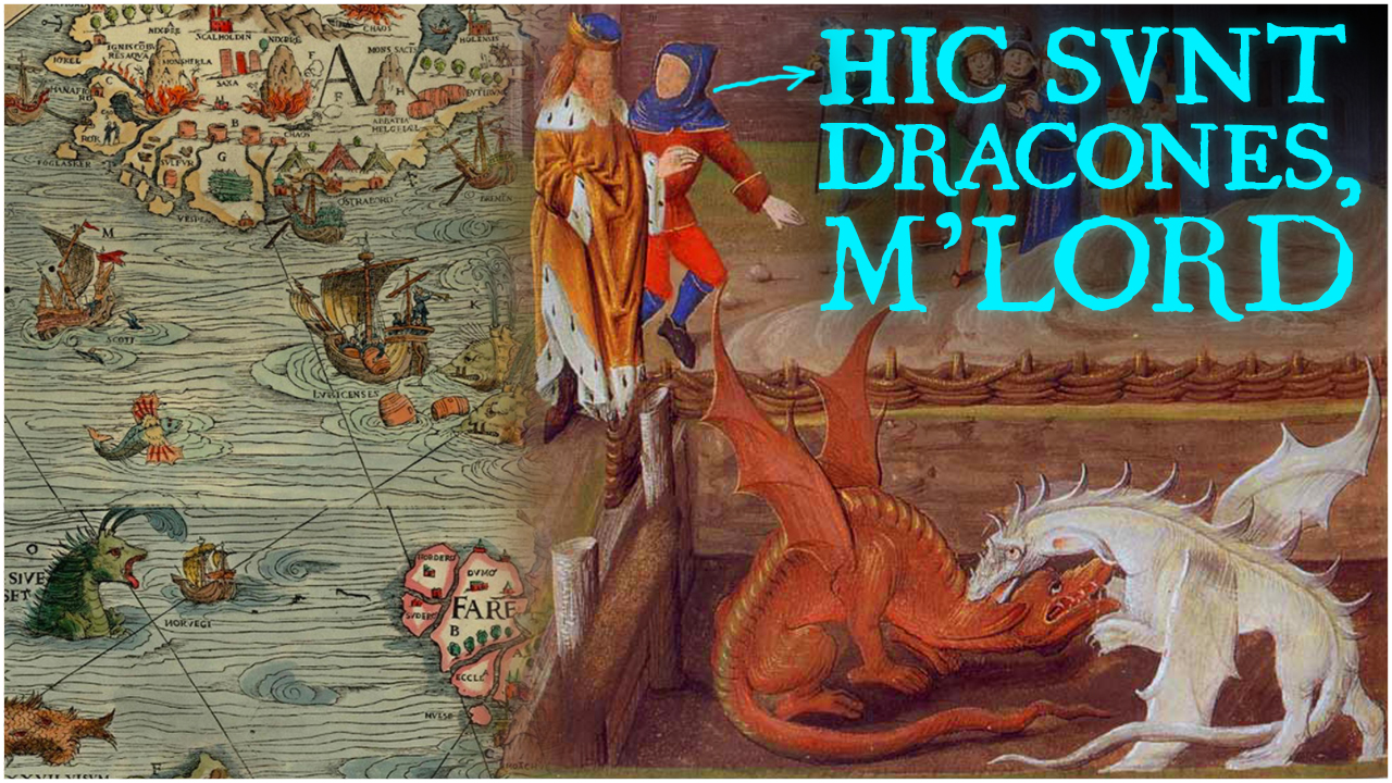
Did Medieval Maps Actually Say “Here Be Dragons”?
 While many think of the so-called “Dark Ages” as a time of profound ignorance and superstition, in reality, medieval people knew far more about the world than popular history typically gives them credit for. But did any medieval map ever have the classic phrase “Here be Dragons”? Let’s find out as we delve into the weird and wonderful world of medieval cartography.
Despite being a popular fixture of fantasy games, books, and other media, the phrase HERE BE DRAGONS – HIC SUNT DRACONES in Latin – only appears on two actual historical maps. The first is the Hunt-Lenox Globe, a 5-inch engraved copper sphere of unknown origin dating to around 1510. Purchased in Paris in 1855 by American architect Richard Morris Hunt and currently owned by the Rare Book Division of the New York Public Library, the Hunt-Lenox globe is the third oldest terrestrial globe known to exist, and only the second to depict the continents of North and South America. By contrast, the oldest known globe – the Erdapfel or “earth apple” – was completed by German printer Georg Glockendon in 1492, before Christopher Columbus returned from his first voyage.
As well as the Americas, the Hunt-Lenox globe includes a large landmass in the middle of the Pacific Ocean, which has been interpreted as evidence that medieval sailors were aware of the existence – if not the exact position – of Australia. But perhaps the globe’s greatest claim to fame is, as mentioned, the phrase HIC SUNT DRACONES, which appears engraved along the eastern coast of Asia. The only other appearance of this phrase is on the 1504 Ostrich Egg Globe, discovered at the London Map Fair in 2012. As the name implies, the globe was crafted from the lower halves of two ostrich eggs joined together. It’s also noteworthy that the map engraved on the Ostrich Egg Globe is nearly identical to that on the Hunt-Lenox, with it speculated that it was likely the prototype for the later globe.
So what’s up with the dragon phrase?
To begin with, some scholars have argued that the phrase Here be Dragons might actually be a mistranslation. For example, in 1879, American historian Benjamin Franklin DeCosta wrote an article on the Hunt-Lenox Globe for the Magazine of American History, in which he claimed:
“In this region, near the equatorial line, is seen “Hc Svnt Dracones”, or here are the Dagroians, described by Marco Polo as living in the Kingdom of “Dagroian”. These people… feasted upon the dead and picked their bones.”
Thus, according to DaCosta, the phrase refers not to literal dragons or other animals but rather to a group of people in East Asia. However, in his annotated reprinting of DeCosta’s article for the Bulletin de la Société Normande de Géographie, French Geographer Gabriel Gravier pointed out that Marco Polo’s Kingdom of Dagorian was likely located on the island of Sumatra in what is now Indonesia – far away from the position indicated on the globe. So perhaps the creator of the Ostrich Egg and Hunt-Lenox maps was referring to dragons after all.
On that note, while the phrase HERE BE DRAGONS appears only twice historically, a similar phrase, HIC SUNT LEONES or “Here be Lions” was frequently used on Roman and Medieval maps, typically along the southern fringes of the Roman Empire in sub-saharan Africa. More commonly, however, the phrases terra pericolosa – “dangerous land” – or terra incognita – “unknown land” – were used to denote unexplored areas, the latter originating in Greek polymath Claudius Ptolemy’s 150 C.E. text Geographica.
Yet illustrations of dragons, sea monsters, and other mythical beasts did often appear in medieval maps, even if they weren’t described in writing. For example, in the Ebstorf Mappa Mundi, a map of the world created by German cleric Gervase of Ebstorf around 1232, southern Africa is depicted as being populated by dragons and basilisks as well as real exotic animals like lions and cheetahs. Similarly, the 1430 Borgia Map, currently housed in the Vatican Library, depicts dragon-like creatures in Asia with the caption:
“Here there are even men who have large four-foot horns, and there are even serpents so large that they could eat an ox whole.”
A 1450 map by Italian cartographer Fra Mauro depicts an imaginary “Island of Dragons” in the middle of the Atlantic Ocean, while Swedish cartographer Olaus Magnus’s 1539 Carta Marina shows terrifying creatures like sea serpents, horned whales, and giant lobsters lurking off the coast of Scandinavia. Similar creatures, including the decidedly awesome ichthyocentaur – part man, part horse, and part fish – also appear in Theatrum Orbis Terrarum, the world’s first Atlas or book of maps, created by Flemish cartographer Abraham Ortelius in 1570.
But while some of these illustrations were simply decorative marginalia – indeed, many surviving maps of this period were intended not for navigation but for display in the homes of the wealthy – others served a number of practical and symbolic functions. In certain cases, they actually depicted creatures which cartographers believed existed and could potentially be a danger to wayward explorers. While the precise origins of dragon myths are unknown, one theory posits that they were inspired – or at least perpetuated by – the discovery of the bones of dinosaurs, whales and other prehistoric creatures. As medieval Christian doctrine held that nature was eternal and unchanging and living creatures could not go extinct, it logically followed that these dragons must still be alive and well somewhere in the distant, unexplored corners of the globe. Similarly, legends of sea serpents were likely inspired by sailors’ sightings of large eels and giant squids and the like. Furthermore, according to an old theory dating back to first century Roman naturalist Pliny the Elder, every animal on land was thought to have an equivalent in the sea – hence why many of the creatures depicted on medieval maps resemble maritime versions of dogs, lions, pigs etc. Indeed, this is the origin of the name sea lions for a family of seals and sea cows for manatees and dugongs – the latter of which are thought to be the inspiration for mermaids.
In other cases, dragons and other mythical beasts on maps served a more symbolic purpose. For example, an 1855 Japanese map called the Jishin-no-ben, which records the damage caused by two massive earthquakes in 1854 and 1855, is surrounded by the figure of a dragon eating its own tail, representing the mythological spirit believed to cause earthquakes. In medieval christian tradition, fire-breathing dragons were often used to represent Satan and the concept of sin. For example, in the Psalter Mappa Mundi, created around 1250, a pair of dragons at the bottom of the map balance out the figures of Jesus and the angels at the top. Indeed, medieval maps were very different from what we are used to today, being less concerned with geographic accuracy than depicting mankind’s spiritual place in the universe. One of the most common cartographic forms of this period was the “T-O” map, so-named because it was drawn on a circle and divided into the three known continents of Europe, Asia, and Africa by three intersecting lines representing the Mediterranean Sea, the Nile River, and the Don River. Unlike modern maps, which place north at the top, T-O maps were oriented with east at the top, with Jerusalem – the holiest city in Christendom – at the centre of the world (and, by extension, the universe).
While strange to modern eyes, for much of history such arrangements were commonplace, with the convention of placing north at the top of a map being a relatively recent development. For example, Ancient Egyptian maps placed south at the top so that Nile River flowed downward, while medieval Islamic cartographers followed the same convention in order to place Mecca – the holiest city in Islam – at the top of the map. It was not until the 14th and 15th centuries that northern-oriented maps started becoming standard – the product of European sailors using the north star Polaris for navigation combined with the introduction of the magnetic compass.
And as explorers began venturing ever further into the unknown and global trans-oceanic trade expanded, maps evolved from whimsical decorations and depictions of a divinely-ordered universe into more accurate, practical tools suited for long-range navigation. Among the first such practical maps were the so-called Portolan maps, developed in Spain and Italy in the early 14th century. While not always oriented with north at the top, these maps did include a prominent compass rose for orientation, as well as lines of latitude and longitude, wind lines, and other information useful to maritime navigators. And while illustrations of dragons and sea monsters became rarer as time went on, for a time these figures were used to indicate areas with rich fishing or whaling grounds. They were also sometimes used as political symbols. For example, German Cartographer Martin Waldseemüller’s 1516 Carta Marina features the figure of King Manuel of Portugal riding a sea monster off the southern tip of Africa, symbolizing Portugal’s dominance over oceanic trade routes.
But while the reasons for medieval cartographers including mythical beasts in their work are not always clear, one thing is certain: they did not believe the earth was flat. Contrary to popular belief, medieval people were well aware that the earth was a globe, this fact having been common knowledge since antiquity. Indeed, around 240 B.C.E., the Greek polymath Eratosthenes succeeded in measuring the circumference of the earth with an astonishing degree of accuracy. Eratosthenes’s method was based on the observation that every year on the summer solstice at noon, the sun could be seen reflected at the bottom of a water well in Syene – modern-day Aswan in Egypt. Assuming that the rays of light from the sun were parallel, this meant that the sun was directly above the well, allowing a line to be drawn from the sun to the centre of the earth. Next, Eratosthenes planted a stick in the ground in Alexandria, and at noon on the summer solstice measured the shadow it cast, giving him the angle between Alexandria and Syene – around 7 degrees or 1/50th of a circle. He then simply multiplied the distance between Alexandria and Syene – measured as 5,000 stadia or around 785 kilometres – by 50 to yield a circumference of 250,000 stadia or 39,250 kilometres – only 2% off from the modern figure. However, over the centuries the work of Eratosthenes and others was constantly reinterpreted, such that by the 15th century the commonly accepted circumference of the earth was 25% smaller than its actual value. It was this error – and not the supposedly heretical belief that the earth was round – that led Christopher Columbus to launch his 1492 expedition and accidentally discover the New World.
And while the fanciful beasts have long since disappeared from all but the most decorative maps, the phrase HERE BE DRAGONS lives on in the field of computer programming, where it is used to indicate sections of code that work for unknown reasons and are best left undisturbed.
Here be Dragons, National Geographic, https://education.nationalgeographic.org/resource/here-be-dragons/
Dempsey, Caitlin, The Map Myth of Here be Dragons, GIS Lounge, August 12, 2022, https://www.gislounge.com/here-be-dragons/
Dempsey, Caitlin, Terra Pericolosa and Terra Incognita, Geography Realm, December 22, 2015, https://www.geographyrealm.com/terra-pericolosa-terra-incognita/
Borneman, Elizabeth, Here Be Dragons: the Facts and Fictions of Mapmakers, Geography Realm, March 7, 2022, https://www.geographyrealm.com/here-be-dragons-map-making/
Dempsey, Caitlin, A Brief Look at Medieval Maps and Travel Guides, Geography Realm, November 26, 2018, https://www.geographyrealm.com/a-brief-look-at-medieval-maps-and-travel-guides/
Danforth, Nick, How the North Ended Up on the Top of the Map, Aljazeera America, February 16, 2014, http://america.aljazeera.com/opinions/2014/2/maps-cartographycolonialismnortheurocentricglobe.html
Neal, Meg, Here be Dragons, Atlas Obscura, July 13, 2017, https://www.atlasobscura.com/articles/here-be-dragons
Waters, Hannah, The Enchanted Sea Monsters on Medieval Maps, Smithsonian Magazine, October 15, 2013, https://www.smithsonianmag.com/science-nature/the-enchanting-sea-monsters-on-medieval-maps-1805646/
Where Be “Here be Dragons”? MapHist, https://web.archive.org/web/20180401000111/http://www.maphist.nl/extra/herebedragons.html


| Share the Knowledge! |
|
 |